
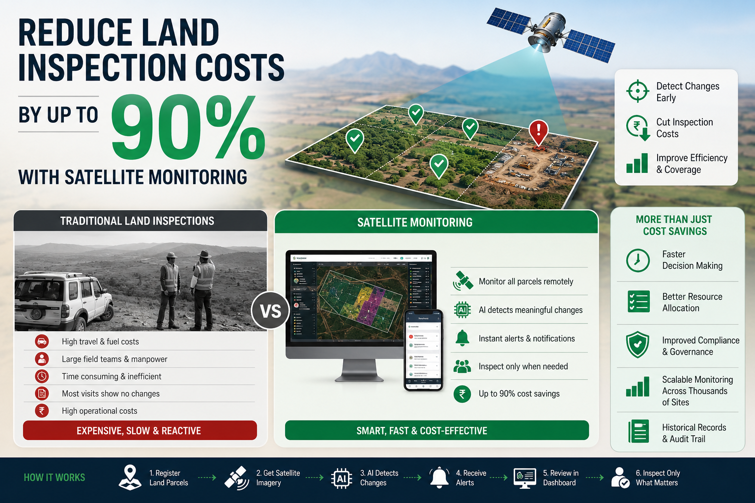
How to Reduce Land Inspection Costs by Up to 90% Using Satellite Monitoring
Managing land assets is expensive. Whether you are overseeing agricultural land, industrial sites, infrastructure projects, government-owned properties, or large real estate portfolios, regular inspections are essential to ensure that the land remains secure, compliant, and free from unauthorized activities.
Traditionally, these inspections involve sending survey teams into the field, travelling hundreds of kilometers, collecting photographs, documenting observations, and preparing reports. While this approach has worked for decades, it is often slow, expensive, and difficult to scale.
Today, satellite imagery and artificial intelligence (AI) provide a far more efficient alternative. Organizations can continuously monitor thousands of hectares remotely, identify changes automatically, and send field teams only when an inspection is actually required. This shift can reduce land inspection costs by as much as 90%, while improving coverage and response times.
Why Traditional Land Inspections Are So Expensive
Field inspections involve much more than simply visiting a site. Every inspection typically includes:
- Travel expenses
- Vehicle and fuel costs
- Survey equipment
- Staff salaries
- Accommodation for remote locations
- Time spent preparing reports
- Delays caused by weather or accessibility
For organizations managing dozens or hundreds of sites, these expenses quickly become significant.
Imagine a company managing 500 land parcels spread across multiple states. Even if each inspection costs only ₹8,000–₹15,000, inspecting every property every month becomes financially unsustainable.
The Hidden Cost: Missed Changes
Ironically, most inspections reveal no significant changes.
Teams may spend days travelling to a location only to confirm that nothing has changed since the previous visit.
Meanwhile, the few locations that do experience important changes—such as encroachment, unauthorized construction, illegal mining, vegetation clearing, or flooding—may remain unnoticed until the next scheduled inspection.
The result is a process that is both costly and reactive.
A Smarter Approach: Monitor First, Inspect Later
Instead of inspecting every property on a fixed schedule, organizations can continuously monitor land using satellite imagery.
Modern Earth observation satellites capture updated imagery every month. AI-powered change detection algorithms compare new imagery with historical observations and automatically identify areas where meaningful changes have occurred.
Only the locations showing significant activity are flagged for human review.
This means field teams visit only the properties that actually require attention.
How Satellite-Based Monitoring Works
A modern land monitoring workflow typically follows these steps:
- Register one or more land parcels.
- Retrieve the latest satellite imagery every month when clouds are not present.
- Compare new imagery with historical images.
- Detect changes using AI algorithms.
- Generate alerts when significant changes are identified.
- Review detected changes through an interactive dashboard.
- Generate Reports for every image.
Instead of manually checking every property, organizations receive actionable intelligence that prioritizes their inspections.
Example Scenario
Consider a company responsible for monitoring 1,000 land parcels.
Using traditional inspections:
- Every parcel is inspected every month.
- Hundreds of staff-hours are spent travelling.
- Most inspections report no changes.
- Operational costs continue to rise.
With satellite monitoring:
- All parcels are monitored automatically.
- AI identifies where changes have occurred.
- Travel expenses, manpower, and reporting efforts are dramatically reduced.
The organization maintains complete visibility while significantly lowering operational costs.
Types of Changes That Can Be Detected
Satellite imagery can help identify a wide range of land changes, including:
- Unauthorized construction
- Land encroachment
- Vegetation loss
- Deforestation
- Illegal mining activity
- Road development
- Waterbody expansion or shrinkage
- Earthmoving activities
- Flood impacts
- Construction progress
Is Satellite Monitoring Accurate Enough?
Satellite monitoring is not intended to replace every field inspection.
Instead, it serves as an intelligent screening system.
Think of it as a watchtower that identifies where attention is needed. Field inspections remain important for legal verification, detailed measurements, and on-site investigations, but they become targeted rather than routine.
This combination delivers the best balance between accuracy, speed, and operational efficiency.
Industries That Benefit the Most
Satellite-based land monitoring is valuable across multiple sectors, including:
- Real estate developers
- Infrastructure companies
- Mining organizations
- Renewable energy projects
- Government agencies
- Forest departments
- Financial institutions managing collateral land
- Industrial parks
- Utility companies
- Environmental monitoring organizations
Any organization responsible for managing geographically distributed land assets can benefit from reducing unnecessary site visits.
How WatchMyPlots Helps
WatchMyPlots is designed to simplify continuous land monitoring for organizations of all sizes.
With WatchMyPlots, users can:
- Register land parcels in minutes
- Continuously monitor changes using satellite imagery
- Receive automated alerts when significant activity is detected
- Visualize historical changes through an intuitive dashboard
- Generate reports for internal teams and stakeholders
- Prioritize field inspections based on real evidence rather than fixed schedules
By shifting from routine inspections to intelligence-driven inspections, organizations can improve operational efficiency while significantly reducing monitoring costs.