
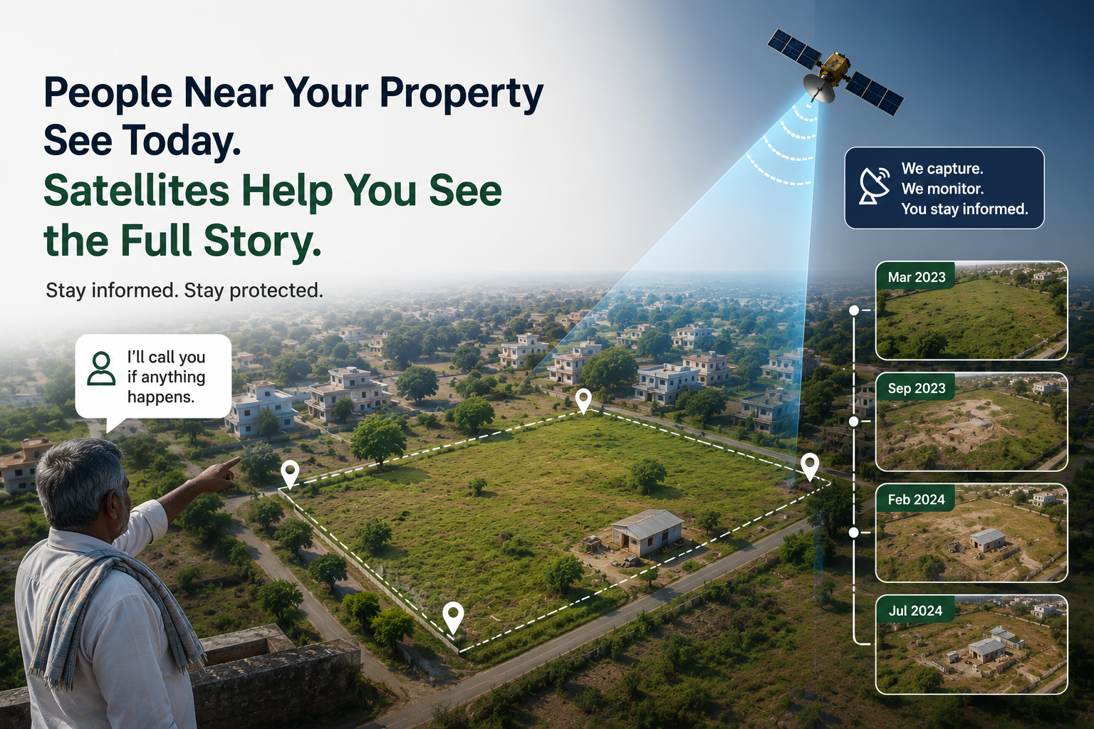
"My Neighbour Keeps an Eye on My Land." So Why Do I Need Satellite Monitoring?
One of the most common questions we hear from landowners is surprisingly simple.
"My land is close to my village, and I know the owner of the neighbouring property. If anything unusual happens, they'll call me. Why would I need satellite monitoring?"
It's a perfectly reasonable question.
In fact, having trustworthy neighbours is one of the biggest advantages a landowner can have. They understand the local area, know who belongs there, notice unusual activity, and are often the first people to alert you when something changes.
Technology should never be seen as a replacement for that.
But there is one important difference between a neighbour and a satellite that most people don't think about until they actually need it.
A neighbour can tell you what is happening today.
A satellite can help you understand what has changed over time.
That difference is more important than it first appears.
Imagine This Situation
Suppose you own a one-acre plot on the outskirts of a growing town. You live in another city because of your job, so visiting the property every month isn't practical.
Fortunately, the owner of the neighbouring farm knows you well. Every few months, you call to ask whether everything looks alright.
The answer is almost always the same.
"Yes, everything is fine."
Years pass without any problems.
Then one afternoon your phone rings.
Your neighbour tells you that someone has started putting up a temporary shed on your land.
Naturally, you leave immediately and reach the property as soon as possible.
When you arrive, you notice a tin structure, construction material lying nearby, and signs that the land has been used for some time.
The first question that comes to your mind isn't who built it.
It's when it happened.
Did the work start yesterday?
Last week?
Two months ago?
Has the surrounding area been changing gradually without anyone noticing?
Even your neighbour may not know the exact answer. They have their own land to manage, their own family, and their own daily responsibilities. They aren't standing at the edge of your property every day, recording every small change that takes place.
That's not a failure on their part.
It's simply not a realistic expectation.
A Single Visit Doesn't Tell the Whole Story
Now imagine visiting your land after a year.
You immediately notice that something has changed.
Perhaps a small road now passes beside your property.
A few new houses have appeared nearby.
Trees have been cleared from one side of the land.
A temporary structure has been built.
Looking at the property today answers only one question:
"What does my land look like right now?"
It doesn't answer questions like:
- Was this structure already there six months ago?
- When did construction actually begin?
- Did the nearby development happen recently or gradually over several years?
- Was the land completely vacant last season?
- How has the surrounding neighbourhood evolved over time?
A single photograph captures one moment.
A collection of photographs captured over months or years tells an entirely different story.
Every Piece of Land Has a Story
Land rarely changes overnight.
Development is usually gradual.
A dirt road becomes a paved road.
A small storage shed becomes a permanent building.
Open fields slowly transform into residential layouts.
Agricultural land begins to attract commercial activity.
These changes often happen so slowly that people living nearby barely notice them.
When an owner visits after several years, everything appears to have changed at once.
In reality, each individual change happened at a different point in time.
Understanding that timeline is often far more valuable than simply knowing the current condition of the property.
This Is Where Satellite Monitoring Becomes Useful
Modern Earth observation satellites capture fresh imagery of almost every location on Earth at regular intervals.
Most people think of satellite monitoring as a way to receive alerts when something changes.
That is certainly one benefit.
But the real strength of satellite imagery lies elsewhere.
It quietly builds a historical record.
Each image becomes another chapter in the story of your land.
Imagine being able to look back and see how your property appeared:
- One month ago.
- Six months ago.
- One year ago.
- Three years ago.
Instead of relying entirely on memory or occasional photographs, you have a visual timeline showing how the land and its surroundings have evolved.
That historical perspective is something very few landowners have today.
People Observe. Satellites Remember.
Neighbours and satellite imagery serve different purposes.
Neighbours provide local knowledge.
They know when new people arrive in the area.
They notice construction activity.
They hear conversations within the community.
Most importantly, they can quickly inform you when something appears unusual.
Satellite imagery contributes something different.
It creates an objective visual history of the property over time.
If someone asks, "Has this area always looked like this?", archived imagery can often provide a much clearer picture than memory alone.
The two approaches complement each other remarkably well.
One provides immediate awareness.
The other preserves historical context.
Most landowners think about documentation only after something unexpected has happened.
By then, reconstructing the past becomes surprisingly difficult.
People try to remember when they last visited.
Old photographs are searched.
Messages are checked.
Friends are asked what they remember.
But memories fade, and photographs are usually taken only during occasional visits.
A historical archive of satellite imagery provides something much more consistent.
It allows owners to revisit the past and understand how visible changes unfolded over time.
Sometimes nothing significant has changed at all.
Sometimes the surrounding area has transformed dramatically.
Either way, the owner is no longer relying purely on assumptions.
Technology Should Support People, Not Replace Them
One of the biggest misconceptions about satellite monitoring is that it replaces local knowledge.
It doesn't.
If you have trustworthy neighbours, caretakers, or relatives living nearby, they remain one of your greatest assets. They understand the local situation in ways that no technology ever can.
Satellite monitoring simply fills a different gap.
It preserves a visual history that no individual is likely to maintain over several years.
Together, people and technology provide a much more complete understanding of what is happening around a property than either could provide alone.
Why WatchMyPlots Includes Historical Monitoring
At WatchMyPlots, we believe landowners shouldn't have to choose between local knowledge and modern technology.
A phone call from a neighbour can tell you that something has changed today.
Historical satellite imagery can help you understand how your property has evolved over weeks, months, or even years.
That combination gives landowners something they have rarely had before—a continuous visual history of one of their most valuable assets.
Because protecting land isn't only about responding to change.
Sometimes, it's about understanding the story of how that change happened in the first place.